 GeoData.NZ
FIELD INVESTIGATION
Type of resources
Topics
Keywords
Contact for the resource
Provided by
Years
Update frequencies
status
-
Sea ice temperature (°C) measured across multiple depths from 20 cm to 207.5 cm at (latitude: -77.775800, longitude: 166.312800): RELATED PUBLICATION: https://doi.org/10.1017/jog.2022.108
-
Sea ice temperature (°C) measured across 11 depths (57 cm, 78.5 cm, 84.5 cm, 87.5 cm, 96.5 cm, 105.5 cm, 108.5 cm, 114.5 cm, 117.5 cm, 120.5 cm, 129.5 cm) at (LATITUDE: -77.781700, LONGITUDE: 166.315300): RELATED PUBLICATION: https://doi.org/10.1017/jog.2022.108
-
Sea ice temperature (°C) measured across multiple depths at (LATITUDE: -77.794900, LONGITUDE: 166.334700). RELATED PUBLICATION: https://doi.org/10.1017/jog.2022.108 GET DATA: https://doi.org/10.1594/PANGAEA.880165
-
Sea ice temperature (°C) measured across multiple depths at (LATITUDE: -77.792300, LONGITUDE: 166.514900). RELATED PUBLICATION: https://doi.org/10.1017/jog.2022.108 GET DATA: https://doi.org/10.1594/PANGAEA.880164
-
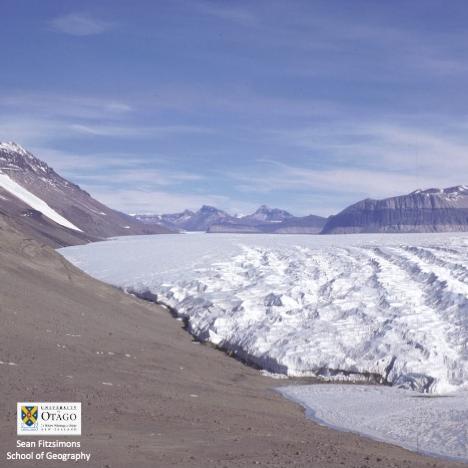
The structural glaciology and movement of the Taylor Glacier, was investigated over several seasons (98-01) by excavating a tunnel in the right side of the Taylor Glacier, 1.5km upstream of the terminus, to provide access to basal ice and the glacier substrate. Basal ice was sampled and analysed for concentration of base cations and chlorides present. Strain arrays and precision dial gauges were installed to monitor movement and deformation of the tunnel and ice velocity. In situ samples of clean and debris bearing glacier ice shear samples were taken from the basal ice to test in a laboratory. The tunnel was re-cut 1.3km upstream of the terminus in the 99-00 season as the other had closed in, with strain arrays and plumb lines installed and basal ice re-sampled. Ice cores were sampled for mechanical tests from the tunnel and the glacier surface. Ice cores were taken from the ice margin of Lake Bonny. Strain arrays and plumb lines were resurveyed and the deformation of the tunnel measured. This metadata record represents: - Data set from Taylor Glacier tunnel - Photographs of tunnel excavation - Video of tunnel excavation Further details are provided at: Fitzsimons, S., Samyn, D., & Lorrain, R (2024). Deformation, strength and tectonic evolution of basal ice in Taylor Glacier, Antarctica. Journal of Geophysical Research: Earth Surface, 129, e2023JF007456. https://doi.org/10.1029/2023JF007456 GET DATA: https://doi.org/10.5281/zenodo.8232003
-
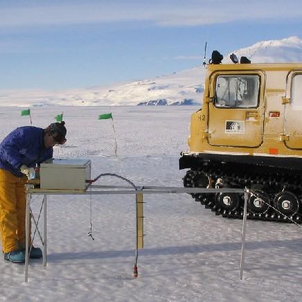
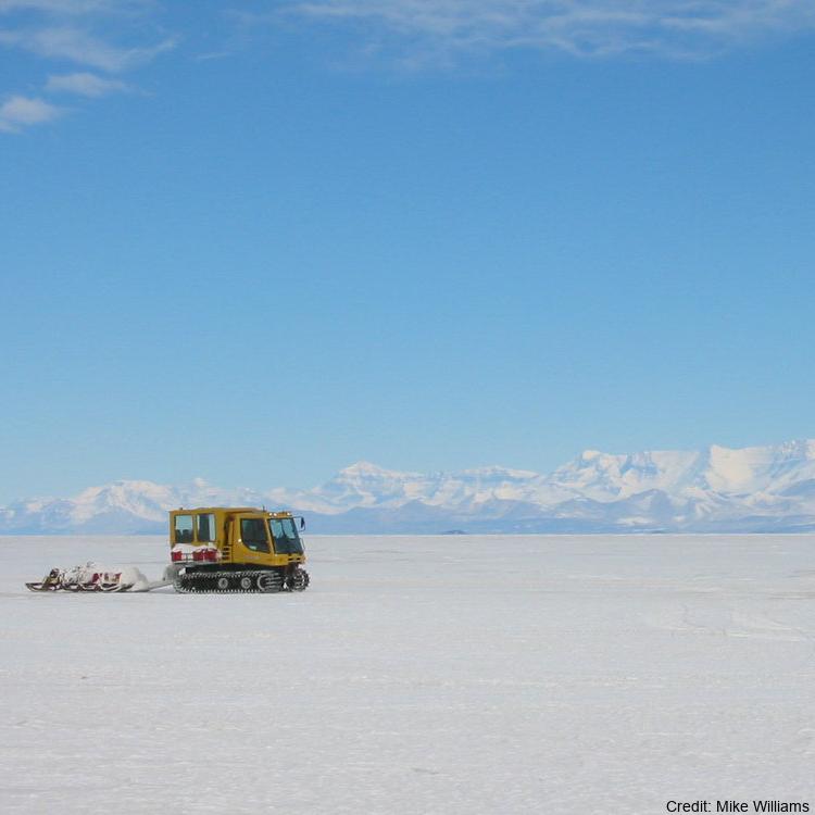
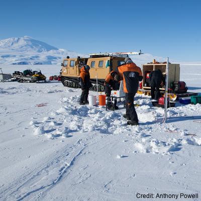
Data provided here have been collected as part of the project "Measurements and Improved Parameterization of the Thermal Conductivity and Heat Flow through First-Year Sea Ice", OPP-0126007* and include measurements of temperature and various ice properties at selected sites in first-year and multiyear sea ice in McMurdo Sound, Antarctica in the years 2002-2004. Data from earlier installations of thermistor chains for measurements of ice temperature carried out by the New Zealand team have also been included. Data files are in Microsoft Excel format, with individual worksheets for specific cores or temperature data sets. Detailed information and comments on data sampling location etc. are provided in the files. Further information on data collection, results etc. can be found in the following publications: Backstrom, L. G. E., and H. Eicken 2007, submitted, Capacitance probe measurements of brine volume and bulk salinity in first-year sea ice, Cold Reg. Sci. Tech. Pringle, D. J., H. Eicken, H. J. Trodahl, and L. G. E. Backstrom 2007, submitted, Thermal conductivity of landfast Antarctic and Arctic sea ice, J. Geophys. Res. Trodahl, H. J., S. O. F. Wilkinson, M. J. McGuinness, and T. G. Haskell 2001, Thermal conductivity of sea ice; dependence on temperature and depth, Geophys. Res. Lett., 28, 1279-1282. Data are in Microsoft Excel format. Abbreviations: AH = Arrival Heights; CH = Camp Haskell (near Delbridge Islands); VUW = Victoria University Wellington; UAF = University Alaska Fairbanks. RELATED PUBLICATION: https://doi.org/10.1017/jog.2022.108 GET DATA: https://drive.google.com/drive/folders/1ooUH9dPvWT66afFC51Cb0JOHg66rn0sy
-
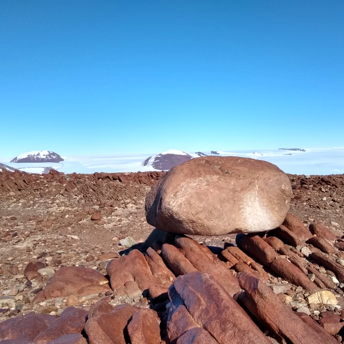
Cosmogenic surface exposure chronologies were used to quantitatively constrain past rates of ice thinning, and the absolute timing of ice discharge and thinning events. We sampled glacial erratics and bedrock from Byrd Glacier (LW1 Nunatak, LW2 Nunatak, Lonewolf Nuntataks, Tiger Nunatak, Mt. Tadpole). Samples were analysed for their exposure history, and all sites contained glacial erratics. In particular, the Lonewolf Nunataks sites, which is located along the margin of the East Antarctic Ice Sheet revealed a plethora of glacial cobbles. Details of laboratory procedures can be found in the related publication. RELATED PUBLICATION: https://doi.org/10.1002/esp.5701 GET DATA: https://version2.ice-d.org/antarctica/publication/1139/